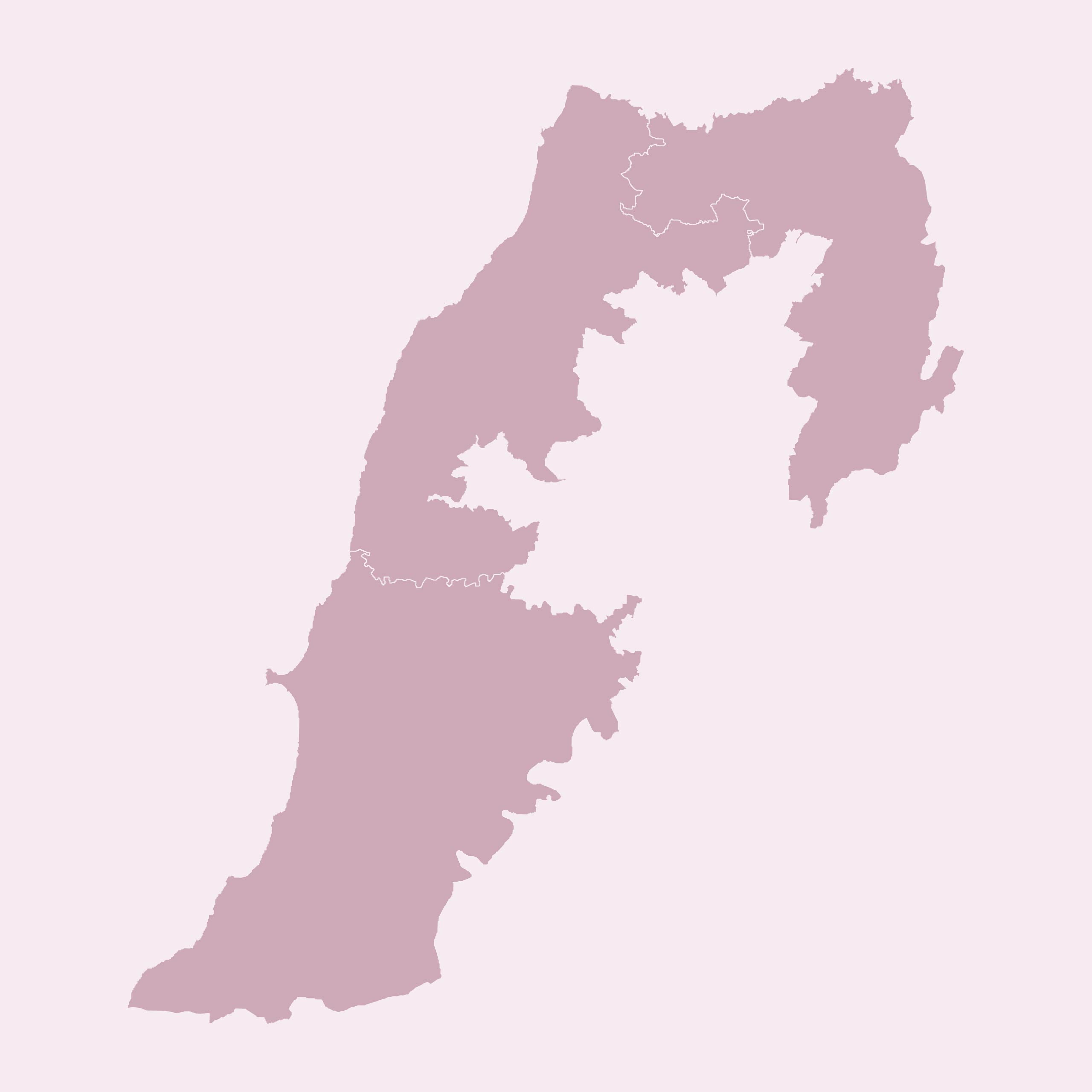
For over 300 days, the war on Lebanon’s southern fronts has ravaged 184 towns, claiming more than 466 lives, including about 108 civilians of which children, refugees, journalists, and aid workers. As a research entity engaged in public affairs, it became crucial for us to understand and document the impact of this war on Lebanese lands, residents, and their livelihoods. Consequently, we decided to devote our efforts at this stage to producing periodic maps documenting Israeli attacks on Lebanon and disseminating them.
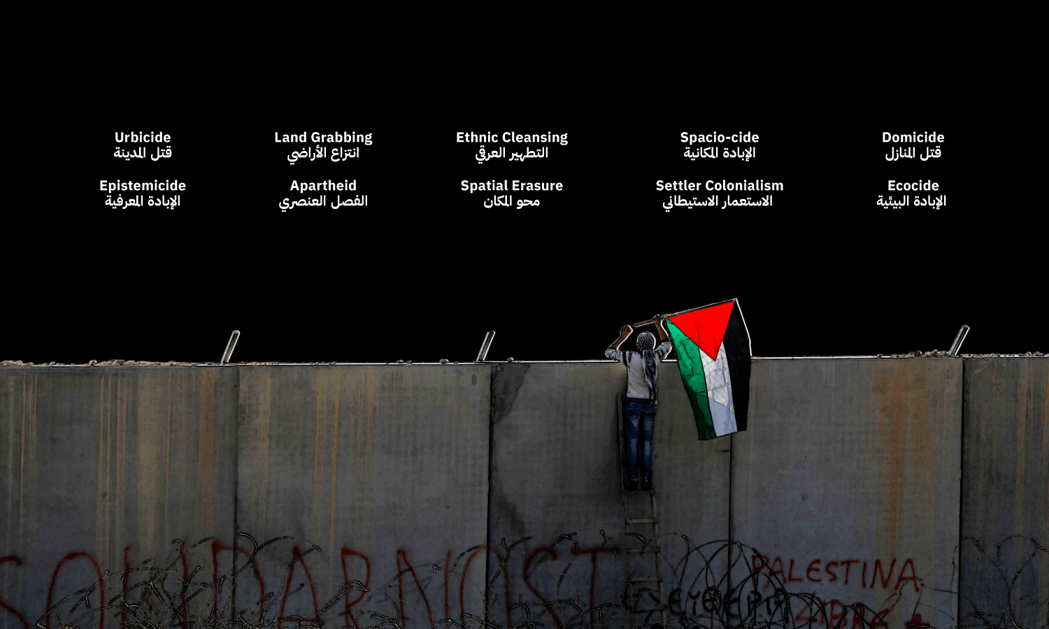
Mapping transcends data analysis; it reshapes narratives and public perception. The design elements—symbols, styles, and what is shown or hidden—give maps political power. Often seen as representations of absolute truth, maps wield significant influence in conveying complex realities.
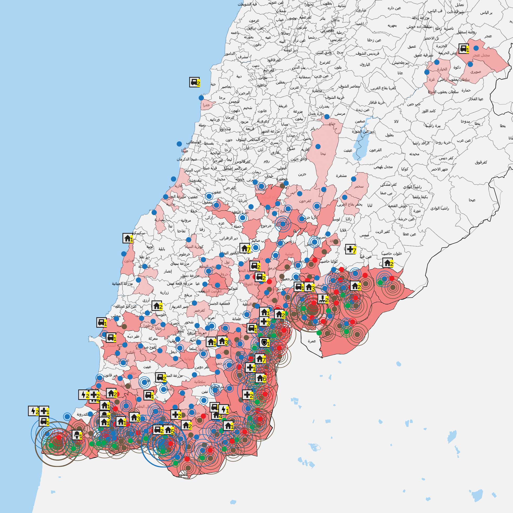
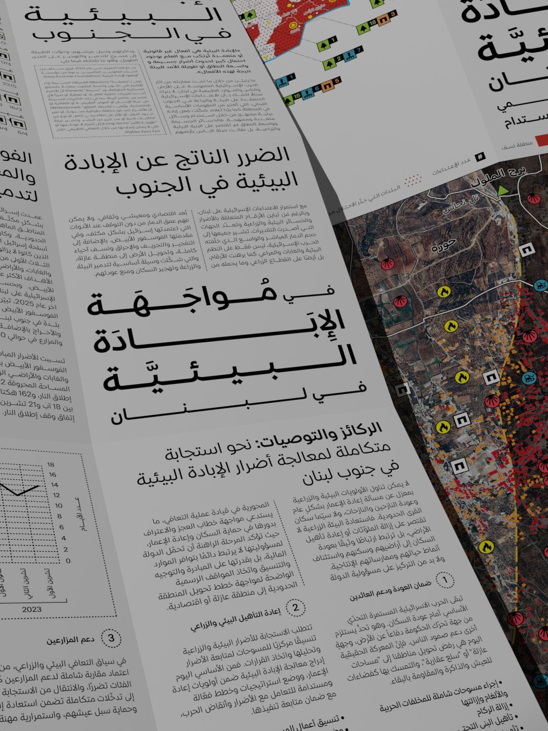
Our latest map of Israeli attacks since October 7 reveals the systematic destruction of homes, infrastructure, and natural landscapes—leading to domicide and ecocide. This visualization goal is to document evidence against the Zionist colonial settlement project and to form a deeper understanding of its brutality and impact on our land and communities, preparing us to develop the various responses needed for survival, recovery, and continuity.
October 8th 2023 – January 31st 2024


October 8th – December 15th


Since the beginning of the Israeli aggression on Gaza, Lebanon has not been spared from Israeli attacks. This map aims to track and document these attacks to understand their cumulative impact on our built and natural environment, and on our lives as residents. It was produced by daily monitoring and collecting data related to the attacks> The attacks were then categorised based on their daily distribution across the towns and sectors of the southern region of the Litani River, and according to the types of attacks conducted by the enemy (artillery shells, airstrikes, illuminating bombs, or phosphorus bombs). It also illustrates the targeted categories (civilians, army, houses, schools, forests, among others), in addition to the number of civilian casualties.
During 40 days since the beginning of the Israeli aggression on Gaza, Lebanon has not been spared from Israeli attacks, whether through artillery shelling or airstrikes. This is not new to an enemy which had occupied our south for decades, had seized our capital in the 1980s, and still occupies parts of our land to this day1 Shebaa Farms and the seven villages: Hunin, Abil al-Qamh, Al-Nabi Yusha, Qads, Al-Malikiyah, Salha, and Tarbikha. It is noteworthy that these seven villages were completely destroyed by the occupation in 1949. What made these villages absent from Lebanese memory is that Resolution 425 did not include them, as their occupation occurred before 1978..
As of November 12, 2023, the Israeli army has targeted more than 60 towns in Southern Lebanon, killing 10 civilians, including 3 girls, either directly or through the destruction of their cars and homes. Nearly 20 civilians were wounded, in addition to 79 martyrs and 13 wounded from the Islamic Resistance.
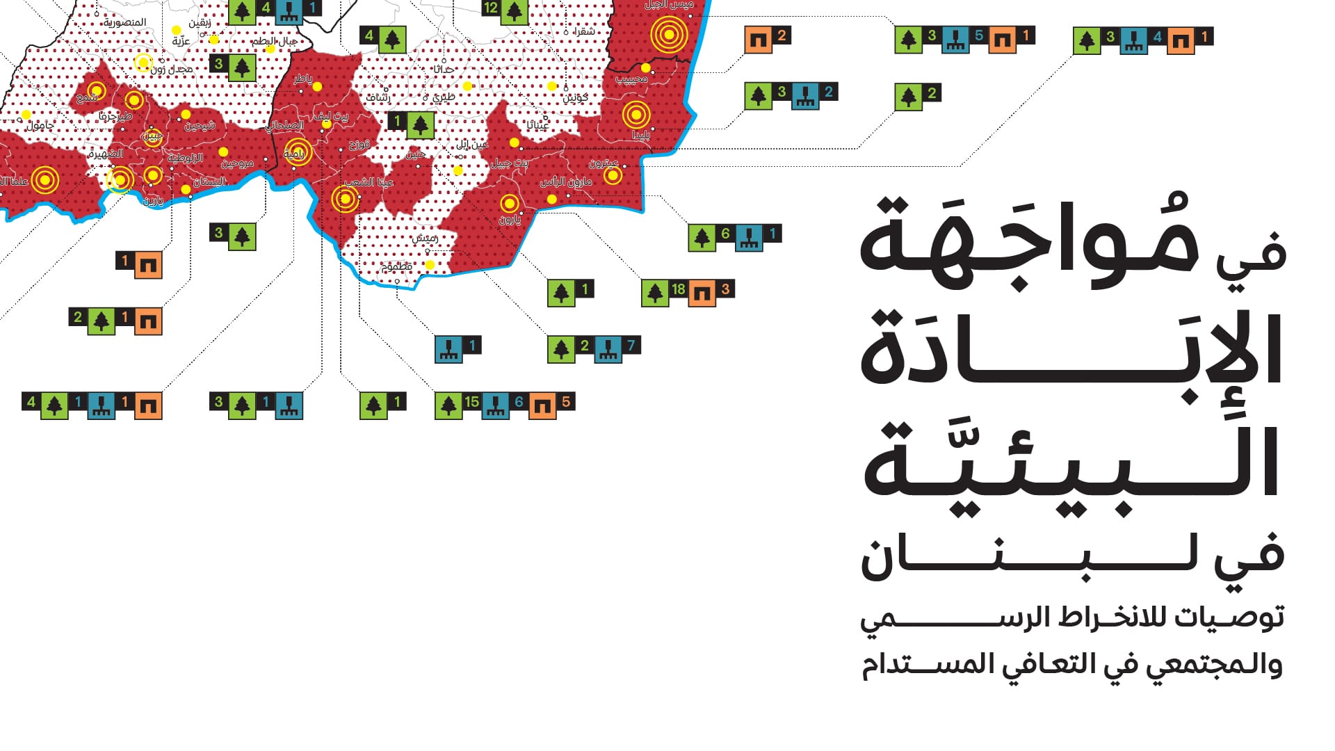
The Israeli enemy also burned over 462 hectares of forests and agricultural lands, as reported by the Environment Minister Nasser Yassin: 60% of the affected areas were forests, 25% were agricultural lands, and 15% were fruit trees and olive groves. The Ministry of Agriculture additionaly documented over 300 fire incidents and the destruction of more than 40,000 olive trees.
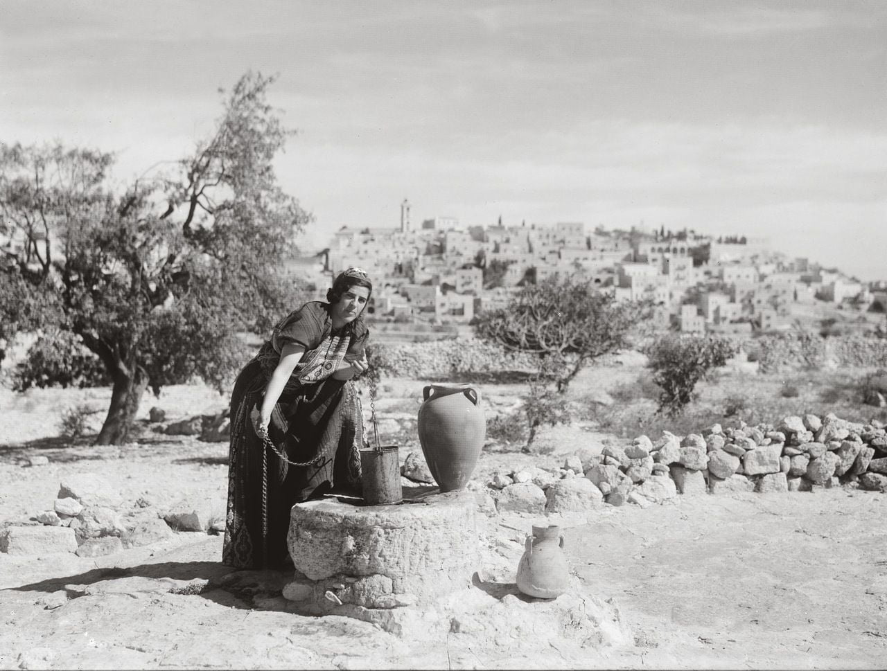
The aggression continues to prevent residents from accessing their lands, crops, and trees, significantly impacting their livelihoods during the olive harvest season, which currently coincides with the aggression. Most inhabitants of the border villages have been unable to harvest their olives, which they eagerly await every year. For instance, the people of Rmeish have been unable to reach over 15,000 olive trees since the onset of the attacks2 According to a talk with the head of the municipality of Rmeish conducted on 11/10/2023. These events have also disrupted the tobacco season- also called the “resilience plant,” which serves as a crucial income source for around 16,000 southern families – as a portion of the harvested crops has been trapped inside houses in several southern villages like Ramieh and Marwahin, due to heavy bombardment.
The enemy also suffocated the residents using the internationally prohibited white phosphorus. The latter being a substance which Israel previously used in Lebanon in 2006, 1996, 1993, and 1982, contributing to deliberate ecocide3 Ecocide is one of the terms that Public Works Studio is working to disseminate its meanings, as part of an effort to encourage the use of accurate vocabulary and phrases to describe what is happening in Palestine and southern Lebanon.https://www.instagram.com/p/CzLpIn3sfwZ/?utm_source=ig_web_copy_link&igshid=MzRlODBiNWFlZA==, aimed at disrupting the balance of nature and eliminating local environmental, cultural, and agricultural means of livelihood. The phosphorus bombs cause devastating and long-term effects on the environment, contaminating both water and soil, and rendering the land unusable for an extended period. It poses a toxic threat to living beings, leading to the mortality of fish, aquatic creatures, mammals, birds, and insects. The enemy deployed this bomb in 17 southern towns over a span of 18 days within the total 37 days of attacks.
The attacks in the southern region also significantly impacted the educational sector, posing a threat to the academic year for thousands of students residing in border areas. The Ministry of Education had to close all schools and vocational institutions situated in the border villages. In contrast, decisions in other southern regions were left to the discretion of the principals based on the circumstances prevailing in their respective areas. Nevertheless, the direct targeting of a public school in Aita al-Shaab heightened the ministry’s concerns which requested that schools across Lebanon remain neutral zones, away from bombings and military operations.
In addition to targeting healthcare facilities and their workers, the enemy artillery shelled the courtyard of Mays al-Jabal Governmental Hospital and repeatedly targeted ambulance teams and their vehicles. Similarly, the Israeli bombardment targeted Lebanese Army centers, ambulance vehicles, Civil Defense and firefighting teams, journalists, UNIFIL forces, and even a solar energy project. Furthermore, 21 houses were directly hit, and dozens more were damaged. This all led to the displacement of a significant number of people estimated by the International organisation for migration at over 40,000 internally displaced individuals across Lebanon. Border villages, such as Kfarshuba, Aita al-Shaab, Shebaa, Hula, and others, witnessed the largest number of displaced individuals.
This map aims to track and document these attacks to understand their cumulative impact on our built and natural environment, and on our lives as residents. It was produced by daily monitoring and collecting data related to the attacks from local media, whether through their social media platforms, televised news, or information shared by field reporters or others. Each piece of information was verified through multiple sources to ensure its accuracy. The attacks were then categorised based on their daily distribution across the towns and sectors of the southern region of the Litani River, and according to the types of attacks conducted by the enemy (artillery shells, airstrikes, illuminating bombs, or phosphorus bombs). It also illustrates the targeted categories (civilians, army, houses, schools, forests, among others), in addition to the number of civilian casualties.
The map takes us back to what was known as the occupied Lebanese strip before its liberation in 2000, the borders of which aligns with the current boundaries of the ongoing attacks. This overlaying of borders and attacks raises questions about the rights of border strip residents in their diverse places of residence, be it their current villages, locations of displacement, or areas of migration. It also addresses the residents’ educational, health, and agricultural conditions, as well as the water and electricity services in the strip.
Southern Lebanon stands as the sole battleground for Lebanon’s confrontation with the Israeli occupation, placing it under the microscope of social-political value, as well as the long-standing state’s relationship with its inhabitants.
October

November

References
- 1Shebaa Farms and the seven villages: Hunin, Abil al-Qamh, Al-Nabi Yusha, Qads, Al-Malikiyah, Salha, and Tarbikha. It is noteworthy that these seven villages were completely destroyed by the occupation in 1949. What made these villages absent from Lebanese memory is that Resolution 425 did not include them, as their occupation occurred before 1978.
- 2According to a talk with the head of the municipality of Rmeish conducted on 11/10/2023
- 3Ecocide is one of the terms that Public Works Studio is working to disseminate its meanings, as part of an effort to encourage the use of accurate vocabulary and phrases to describe what is happening in Palestine and southern Lebanon.https://www.instagram.com/p/CzLpIn3sfwZ/?utm_source=ig_web_copy_link&igshid=MzRlODBiNWFlZA==

The Reconstruction Draft Law repeats the Mistakes of the past:
Reviving destroyed villages can’t happen only through buildings
After a ceasefire was implemented in Lebanon on November 27, the Lebanese government held a special session on December 7 in the southern city of Tyre and approved a draft law for rebuilding ...