development

Lessons from the “Waad” Reconstruction Project

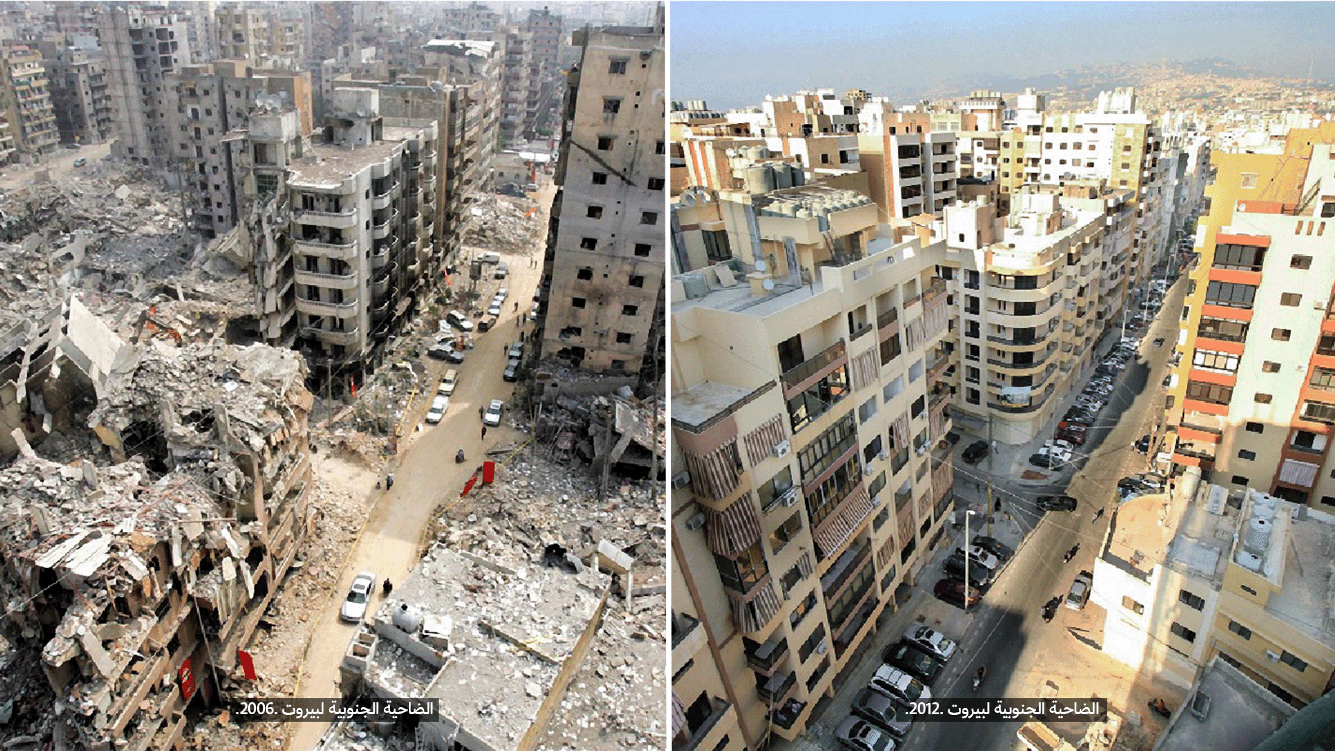
After thirty-three days of continuous bombardment that killed more than 1,000 people, the 2006 war affected a total of 1,232 buildings, mostly residential.
On November 14, 2006, a meeting was held with residents, where they expressed one primary concern: returning to their homes as soon as possible. Accordingly, the local political party promised to rebuild Beirut’s southern suburbs, making them “more beautiful than before,” as the slogan of the project became.
In this text, we present the project and its challenges, especially at the urban level.
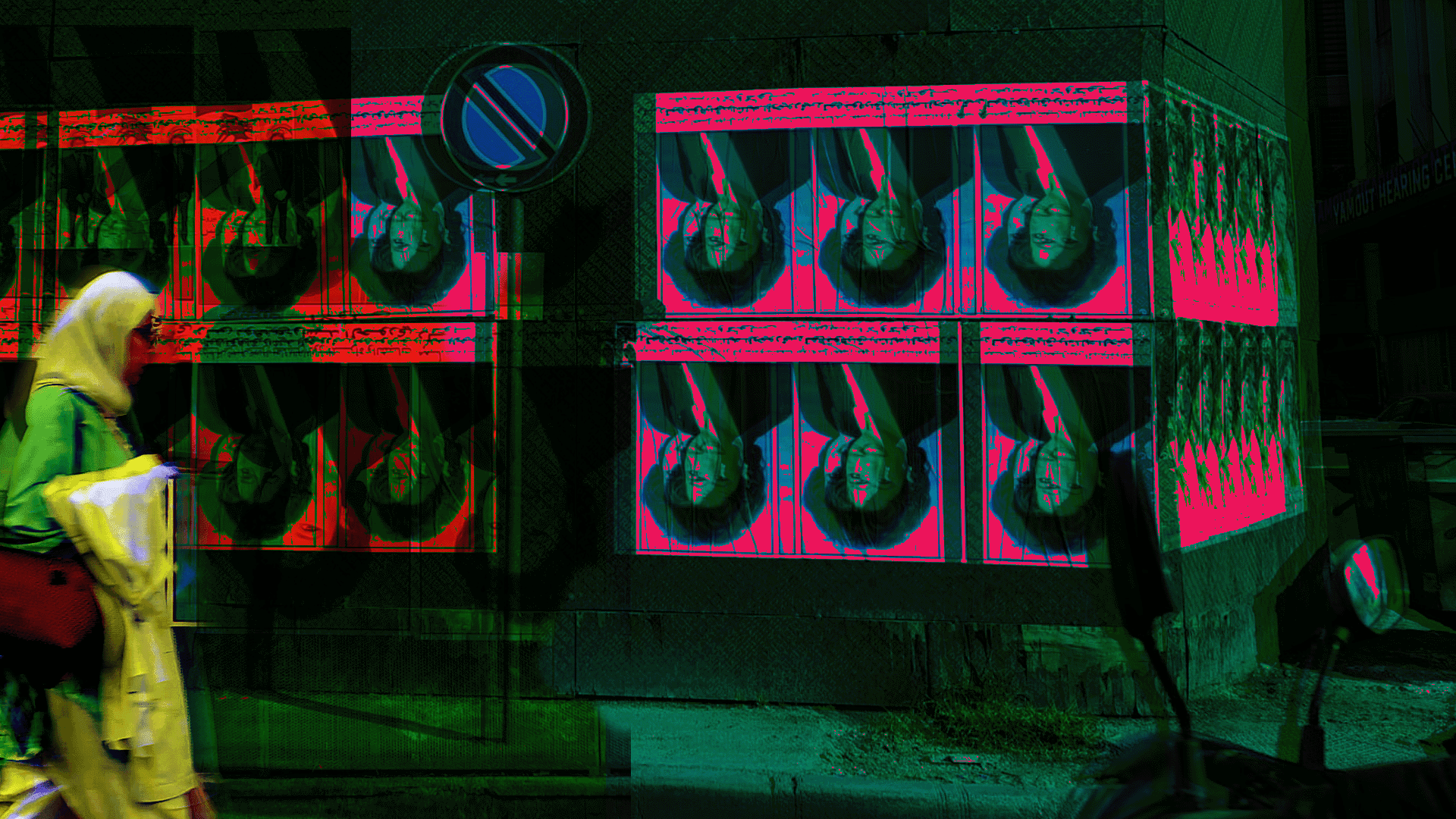
Aita al-Shaab: How do we rebuild a village?

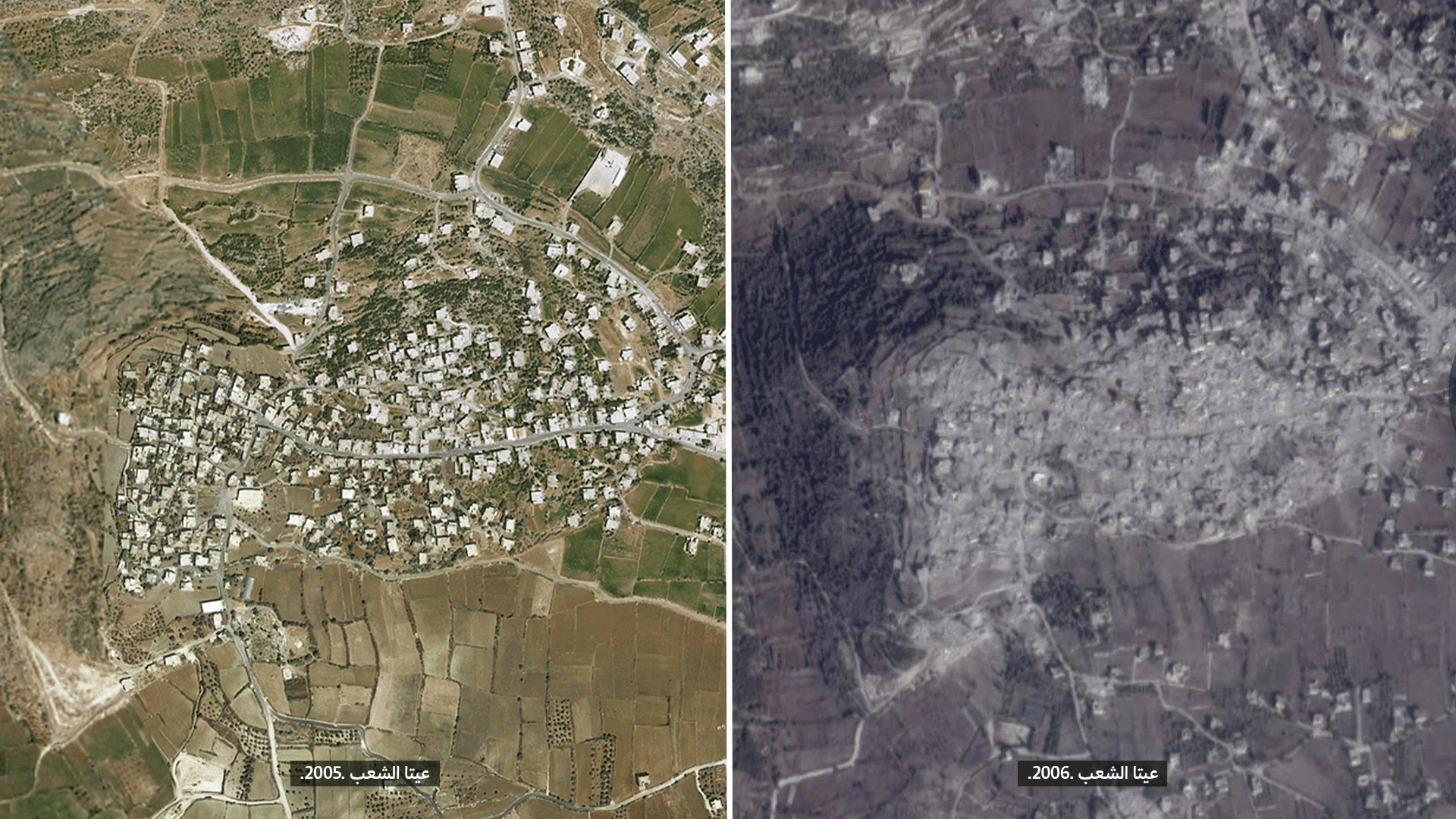
Bulldozing the old neighborhood in Aita al-Shaab, a Lebanese village on the southern borders, following the 2006 israeli war, the solidere-like approach to reconstruction, or the many stories we heard from returnees and their experiences during the war, highlighting the meaning of losing their home, their village, and their community. We will attempt to address these three levels through this text, while exploring the experiences of a group of urban planners who volunteered to support reconstruction efforts in the village immediately after the war.

Who’s Beirut?

On the Necessity of a Unified Conception of the City that Goes Beyond its Municipal Borders

Over the course of more than a century, Beirut has witnessed a radical transformation and tremendous urban and population growth intertwined with major historical events. Aerial maps show this expansion, but also they raise a basic question: Who is Beirut today, with its urban complexities and interactions?

Master-Planning in Lebanon: Manufacturing Landscapes of Inequality

How is urban planning practiced in Lebanon? What is the motive behind issuing master plans? And in what way do these plans violate fundamental rights? We tried during the years 2017 and 2018 …

Editorial

During the past decade, many researchers have studied the relationship between geography and law in an attempt to clarify the links between these two increasingly complex concepts. In reality, comparing law and the …

Interview with Engineer Rabih Taksh

Member of Nabatieh El Tahta Municipality for 28 Years and Director of "Jihad al-Bina" in South Lebanon after the 2006 War

The interview with Engineer Rabih Taksh was conducted by Public Works Studio as part of the project “Planning in Lebanon: Manufacturing Landscapes of Inequality” (2017-2018). It explores the transformation of land use in …

Interview with Engineer Mohammad Fawwaz

Ex-director of the General Directorate of Urban Planning (1973-1993)

The interview with Engineer Mohammad Fawwaz was conducted by Public Works Studio as part of the project “Planning in Lebanon: Manufacturing Landscapes of Inequality” (2017-2018). It explores the history of urban planning practice …

How to Protect Residents of the Neighborhoods Affected by the Beirut Port Explosion

In the aftermath of the Beirut port explosion on August 4, 2020, residents of the affected neighborhoods in particular, have been excluded from topics related to their lives. Seeing the result of the …

How to Protect Residents of the Neighborhoods Affected by the Beirut Port Explosion?

In the aftermath of the Beirut port explosion on August 4, 2020, residents of the affected neighborhoods in particular, have been excluded from topics related to their lives. Seeing the result of the …

Beyond Cement:

Towards an Alternative Vision for Chekka and Surrounding Towns

The towns of Chekka and Koura in North Lebanon have become prime examples of what public policies in Lebanon generate. The “Green Koura” in residents’ memories sat atop an abundance of groundwater and …

Beyond Cement

Towards an Alternative Vision for Chekka and Surrounding Towns

Download the book in Arabic Research and production: Monica Basbous, Nadine Bekdache, Tala Alaeddine, Abir SaksoukDesign: Imad KaafaraniEditing: Hashem HashemReport localisation: Sassine Kouzli Due to the presence of cement factories and quarries on …

Planning in Lebanon:

Manufacturing Landscapes of Inequality

Urban planning and land use maps are a reflection/embodiment of the country’s larger policy choices and economic conceptions. It is the voice and instrument of authority, as it includes the political-economic vision and …