Land Policies Observatory

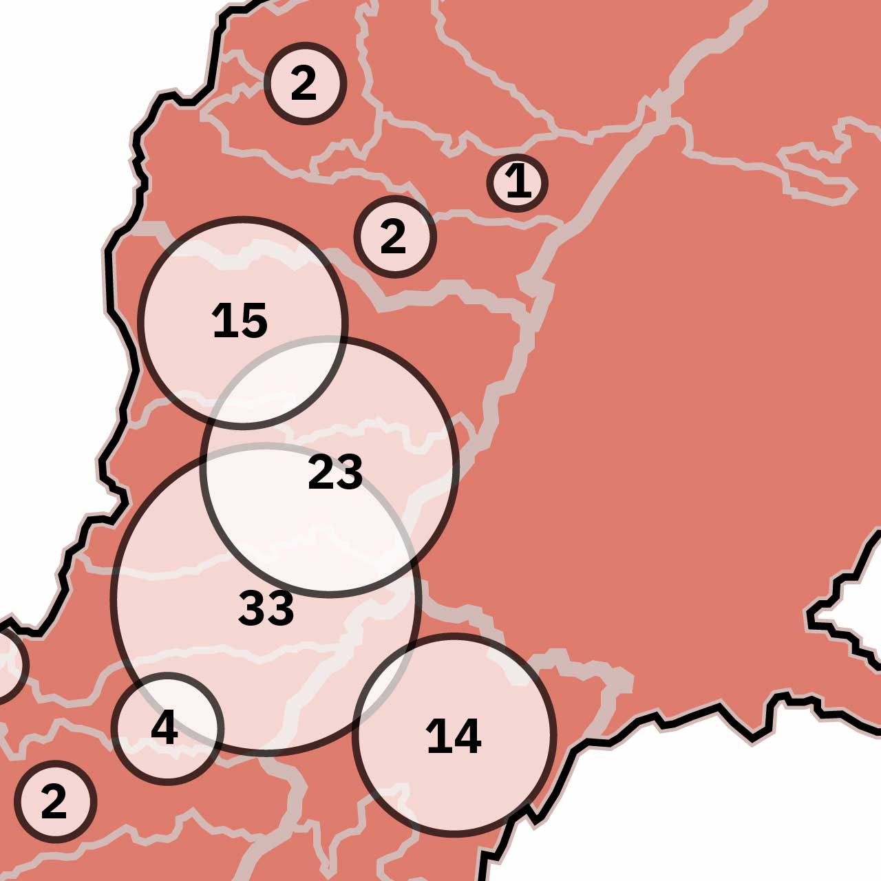
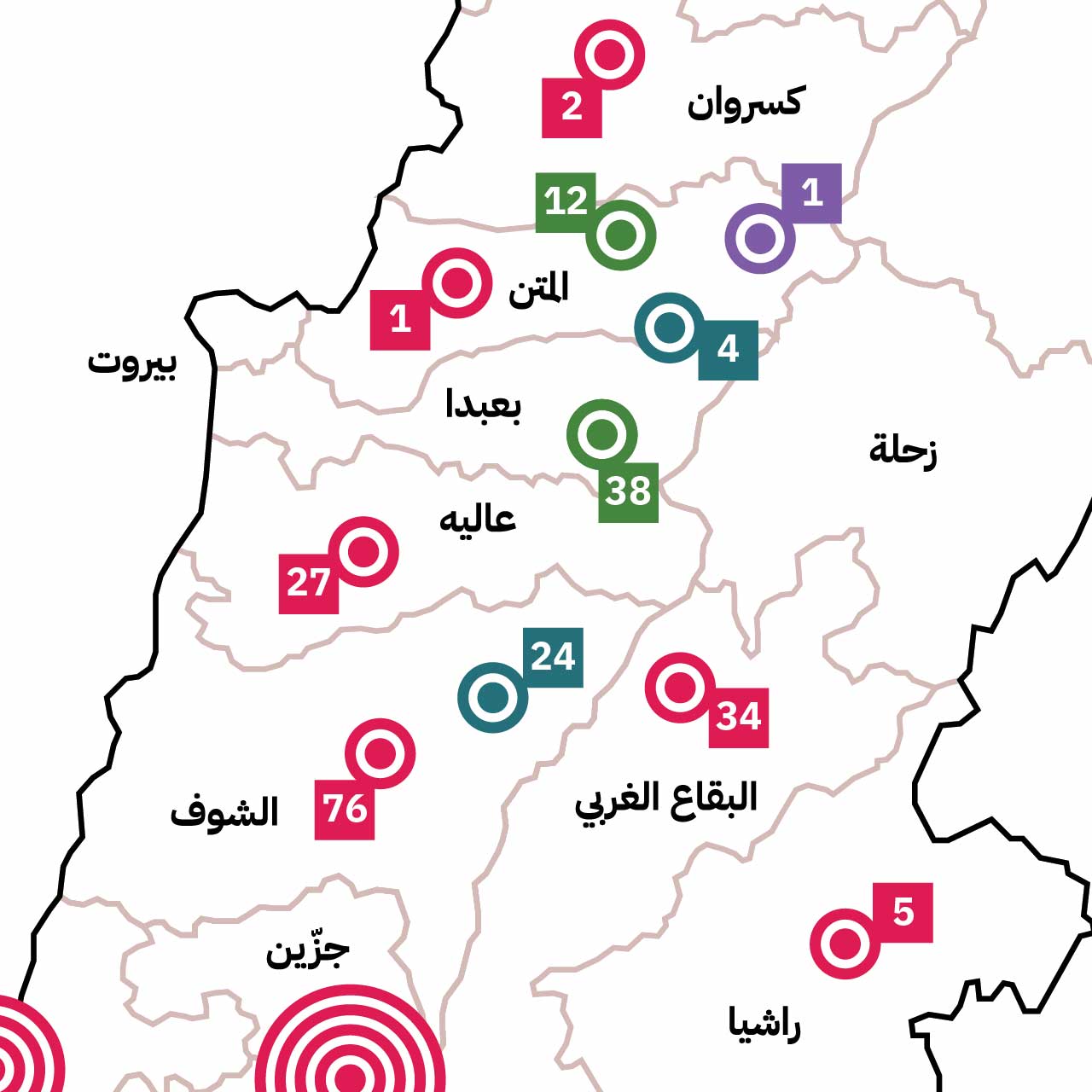
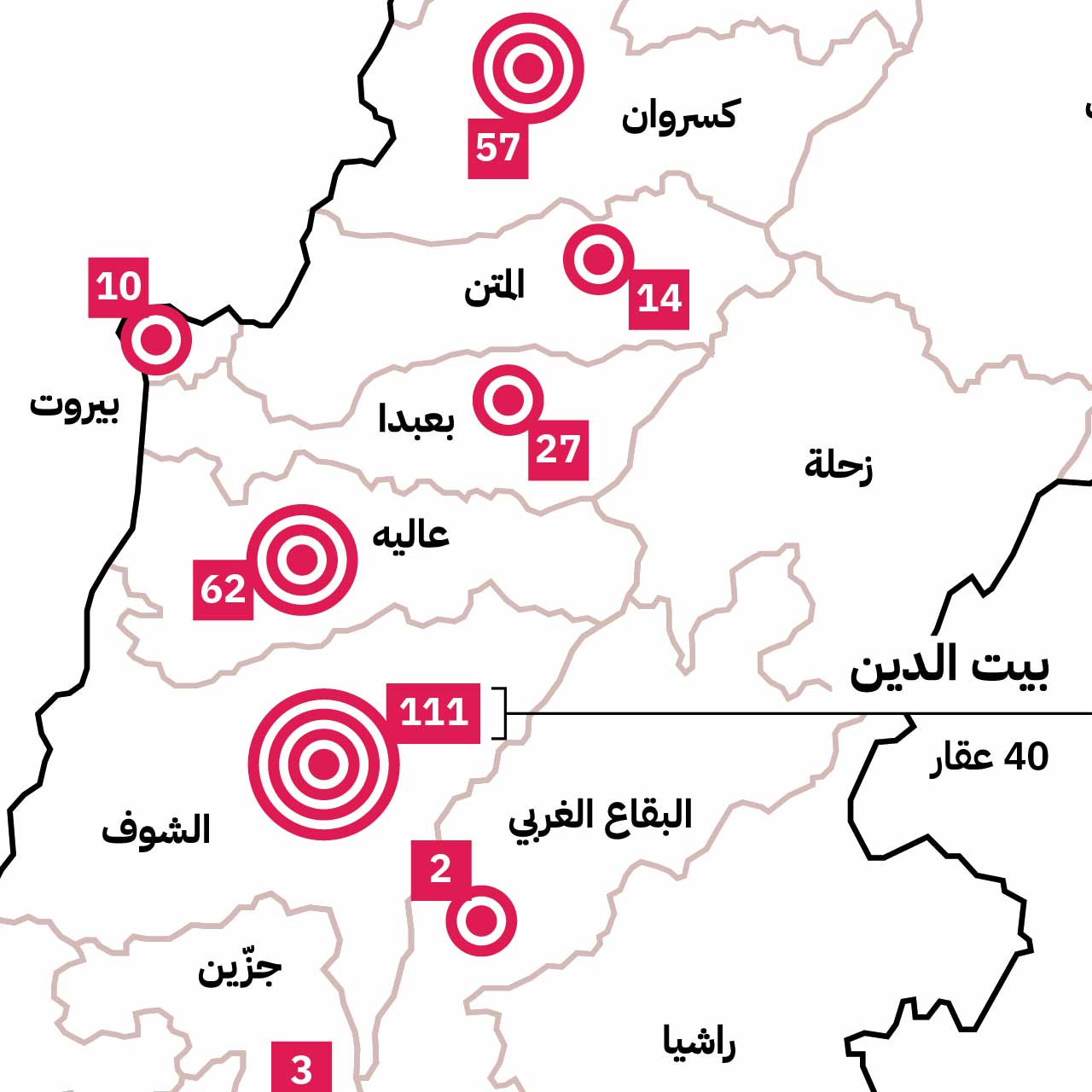
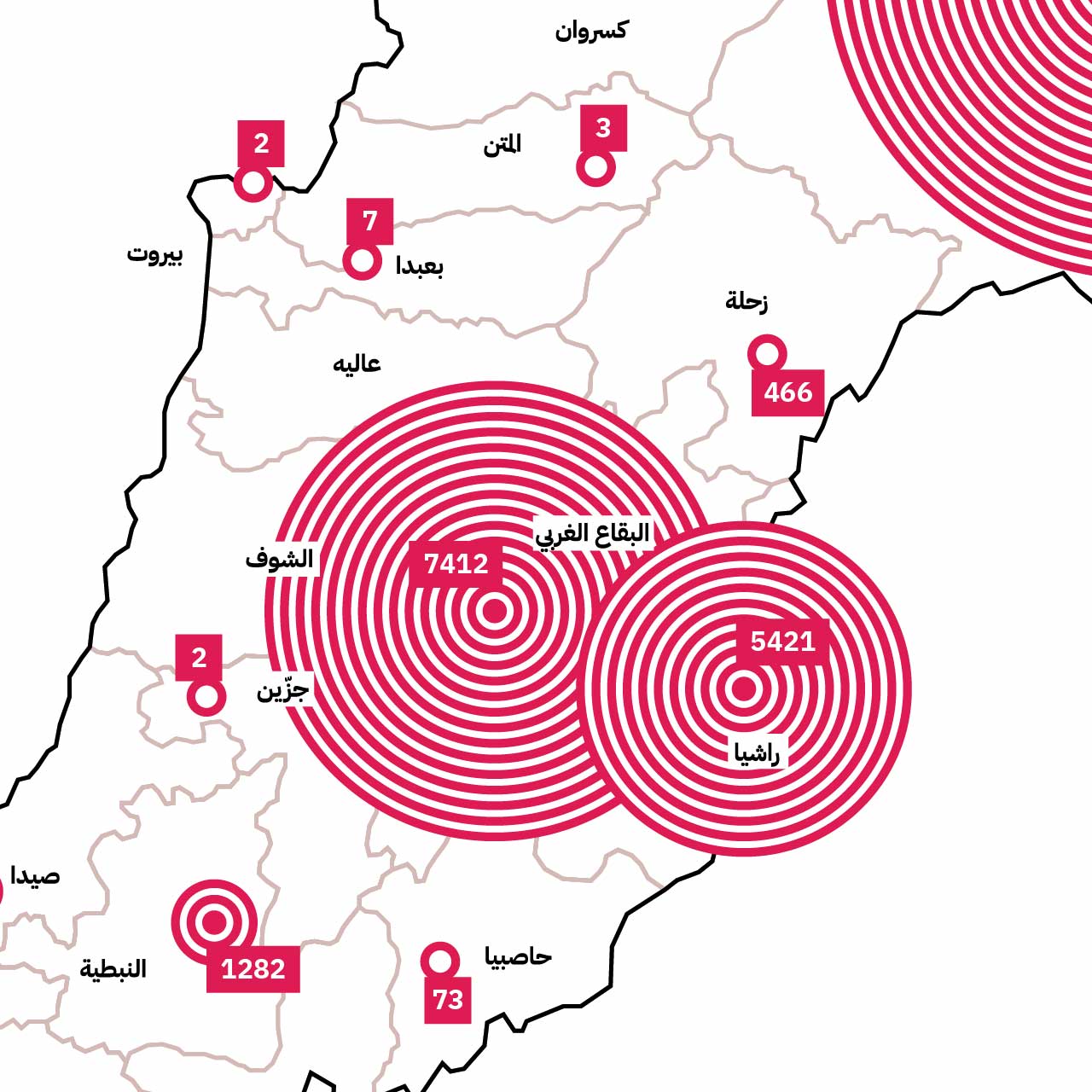
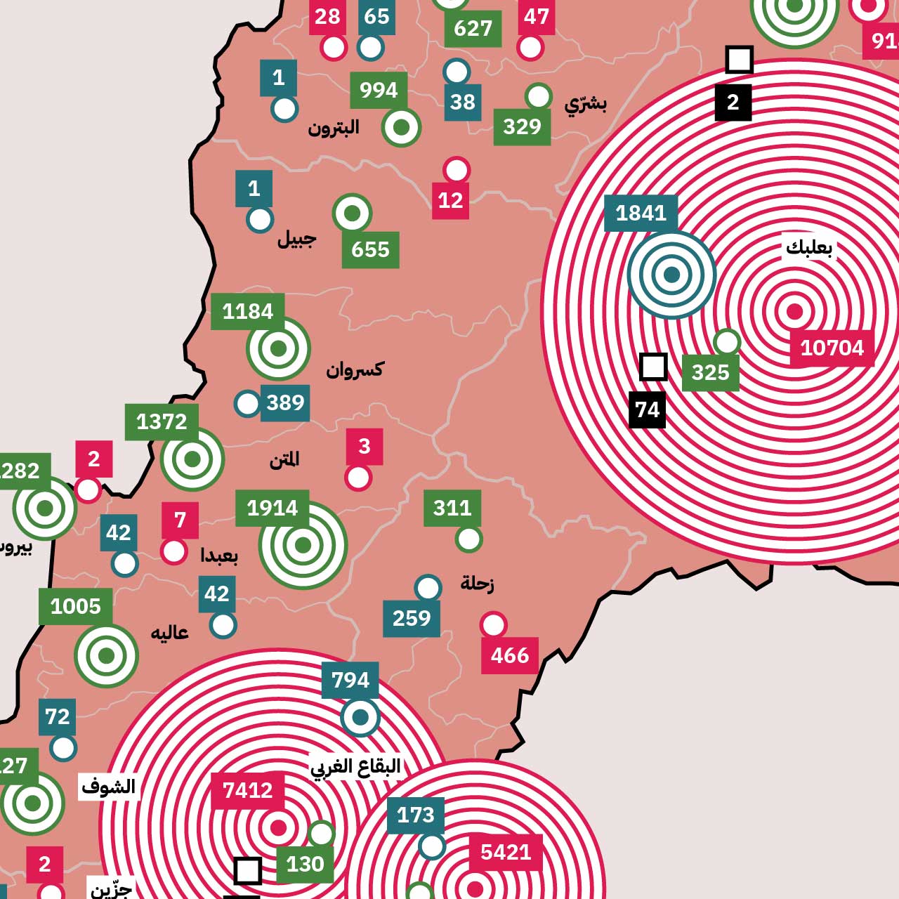
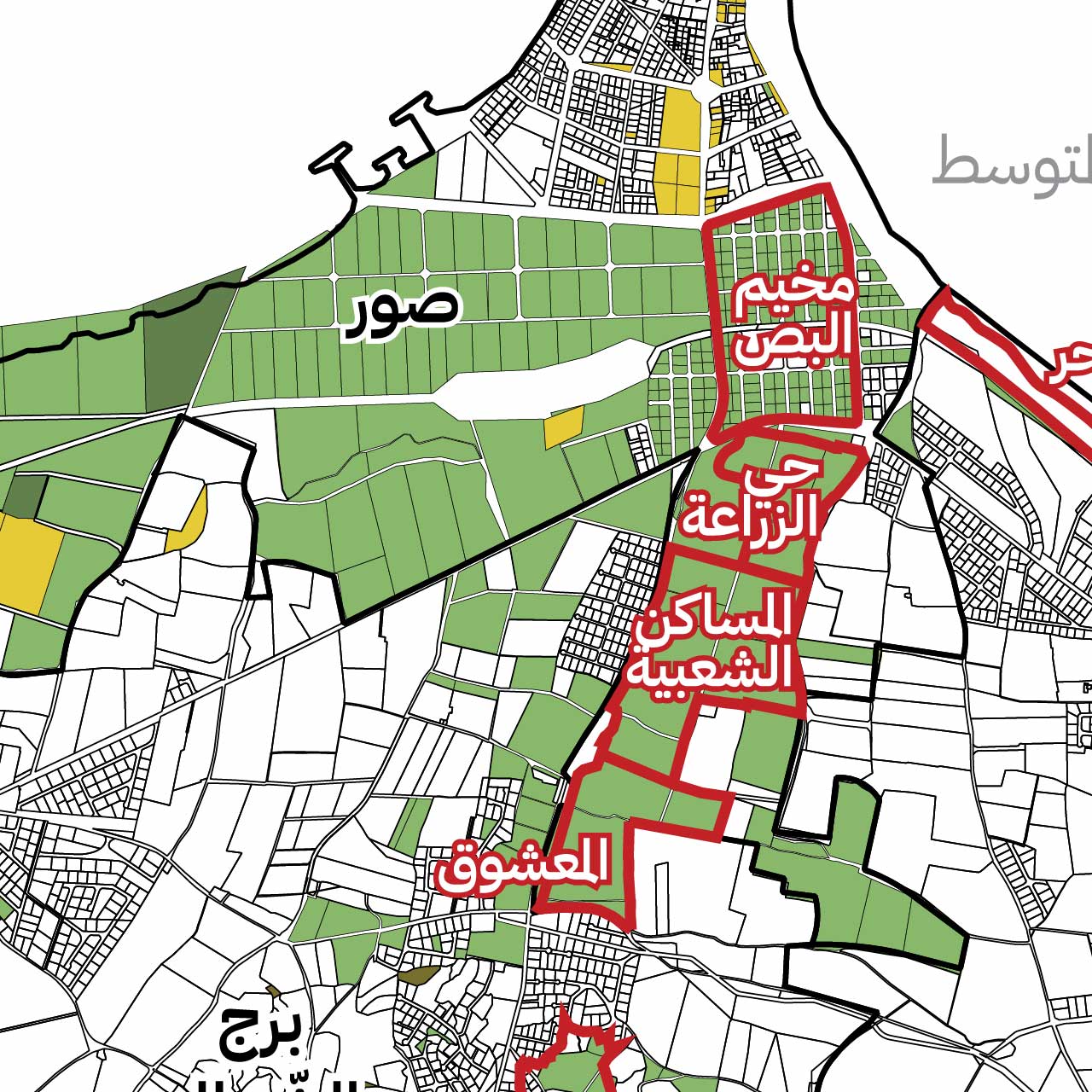
Distribution of Private State Property in Tyre City, Borj Ech-Chemali and Aabbassiye

Amiri public lands constitute 62 per cent of Tyre’s area, while state-owned lands of all types amount to 70–75 per cent of the city. The current uses of these lands are diverse, but …

Count of Public State Property Reclassification Decrees (per district and timeframe)

The state’s “public” property — legally known as “reserved protected land” includes any property meant to be used in the public interest, such as riverbeds, riverbanks, sea shores, waterfalls, lakes, irrigation canals, roads, …

Distribution of State Property Designated for Public Housing (by District and Public Institution)

A significant number of state-owned lands in Lebanon are registered in the land registry under the names of several ministries, departments, or directorates concerned with housing. As per the 2015’s data retrieved from …

Geographical Distribution of Real Estate owned by Banque du Liban BDL (by District)

Among the registered proprietors of state property is the central bank, Banque du Liban (BDL), which owns a vast portfolio of 1,037 plots of unbuilt state property. BDL owns full shares in some …

Geographical Distribution of Amiri State Property (by District)

Amiri lands constitute the majority (52 percent) of all real estate belonging to the Lebanese state, or 31,907 different properties. The district of Baalbek alone includes more than 33% of the total Amiri …

Geographical Distribution of Private State Property (by District)

According to Lebanon’s Real Estate Property Law (Resolution no. 3339 of 1930), there are 5 types of state-owned lands, which fall under two main categories: Public State Property and Private State Property. Private …

Towards Planning Justice

Take Action, support causes that impact our daily lives, spaces, cities and futures. Join our actionsReport violations in your region Let us take action on specific issues Report violations in your region

The Council of Exceptions: A report on the decisions of the “Higher Council for Urban Planning” (2019-2021)

The General Directorate for Urban Planning and its higher Council are Lebanon’s official and primary bodies for urban planning. They support urban development and favor the interests of real estate developers and the …

The General Directorate and Higher Council of Urban Planning

Read details in Arabic here.

North Governorate

This governorate includes a significant number of state-owned properties (4,278 plots), and 23% of its area is fully or partially planned. According to the recommendations of the NPMPLT, it is supposed to be given a privileged position in maritime transport, industry, tourism, international exhibitions, and higher education.

Kesrwane-Jbeil Governorate

This governorate has the lowest number of state-owned properties after Beirut Governorate (2229 plots), with 19.8% of its area planned or partially planned. The NPMPLT indicates that organizing its urban structure to accommodate the future demographic and urban growth of the whole Central Urban Area (Beirut and Mount Lebanon), remains one of the main challenges.

Mount Lebanon Governorate

This governorate has a considerable number of state-owned properties (5584 plots), with 37.9% of its area planned or partially planned. The NPMPLT indicates it will accommodate the future demographic and urban growth of the whole Central Urban Area (Beirut and Mount Lebanon), therefore, it would be convenient to organize it by defining its urban structure.